-
-
-
-
Caris Cloud Technology Project
Caris Cloud Technology Project
-
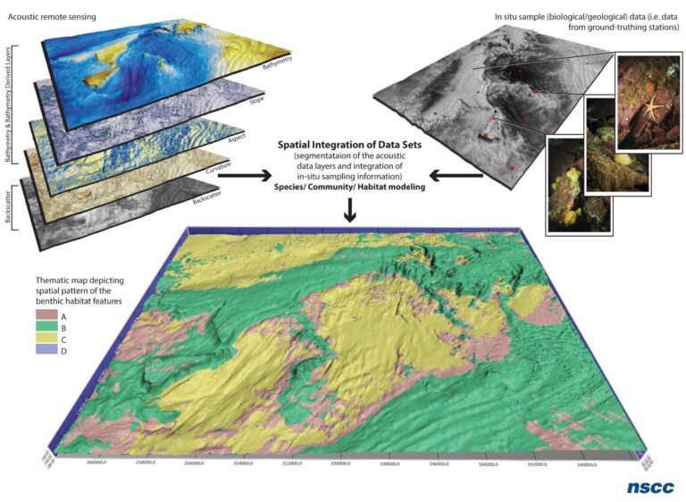
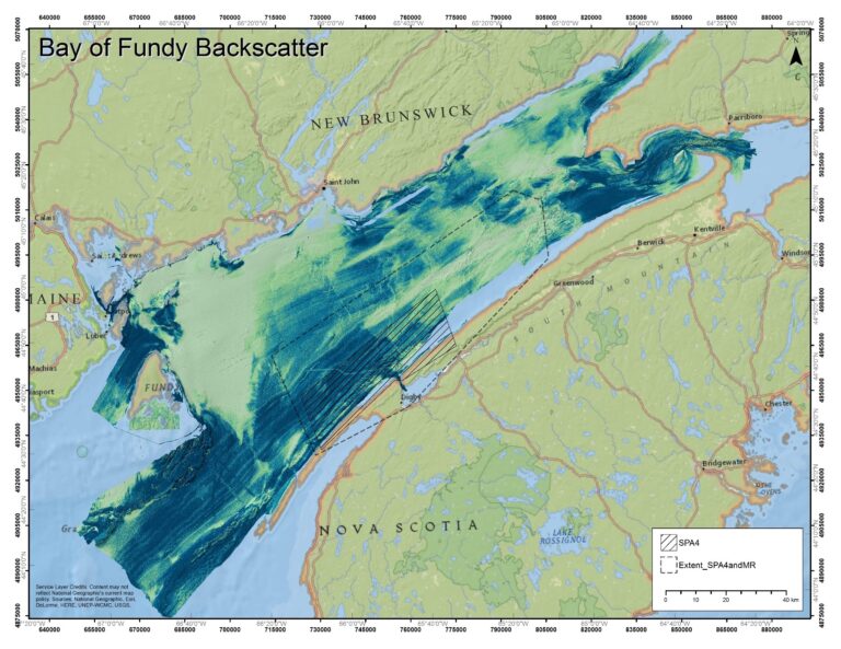
Processing of MBES Backscatter for Benthic Habitat Mapping/ Species and Community Habitat Mapping of the Bay of Fundy
https://dfo-mpo.gc.ca/science/collaboration/partnership-projects/049-eng.html
-
Hydrography to Biology: Developing Integrated Approaches for Benthic Habitat Mapping
https://www.dfo-mpo.gc.ca/science/collaboration/partnership-projects/032-eng.html
-
Crowd-Sourced Bathymetry in the Northern Canada Area
See Details Here: Crowd-Sourced Bathymetry in the Northern Canada Area (dfo-mpo.gc.ca) The Hydroball Project: Crowd Source Bathymetry in Northern Canada Article Preview – The Journal of Ocean Technology (thejot.net)
-